Something I always struggle with when making an overland map is getting the terrain to look right together. How does one design a map to look "real"? I'm not a geographer. I had tried out the map generators in HexKit, but never really got them to look right. The custom generators are interesting, but a bit mystical in how they work. Searching around I cam across an interesting link from The Welsh Piper's blog: Hex-based Campaign Design (Part 1). This article is based on another which I can't seem to get to, but the gist is that you map your hexcrawl on an ad hoc basis, generating successive rings of hexes around your PCs starting location.
The article from The Welsh Piper expands on this and provides a random method for generating hexes and for then sub-dividing hexes into terrain types based on the main terrain. This is what drew me in. The article includes a chart with the primary terrain type of the large hex along the top (I was reading down the left for primary terrain which makes the chart confusing), and then list which of the other types are Secondary, Tertiary or Wildcard types. The basic idea is that 1/2 of the full sub-hexes will be the same as the primary terrain type, 1/3 will be the secondary terrain and then the remaining 1/6 of the full hexes will be tertiary or wildcard. The half hexes along the edge of the sub-hex then get assigned any terrain type except wildcard. There are some footnotes in the chart for modifying the different terrain types based on the primary terrain (for example a % chance that hills are forested or that some mountains might be volcanic etc.)
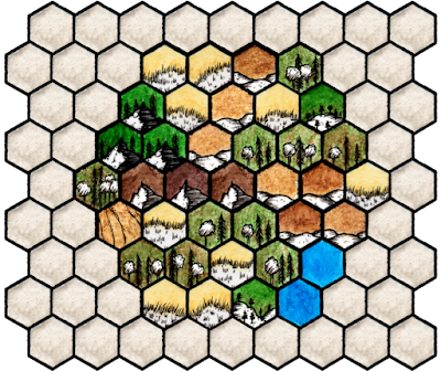
There is then a random table for determining what the adjacent larger hex will have as it's primary terrain based on the primary terrain of the current hex. Seemed like neat system so I tried it out. First off I picked Mountain as a primary terrain type for the starting hex and broke it down based on the chart. The below map is the result:
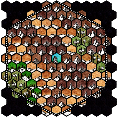
I think this turned out alright. Having a guideline made things a little bit easier. I rolled randomly to see what the terrain of the larger hexes around the starting hex would be and started making the regional map. For the adjoining hexes on the regional map I went out 3 rings from my starting hex (mountain tile in the centre) to see what the random generator would give me:
 |
| Regional Map |
Looks OK. I'm not sure it looks organic though. It seems like this method would be neat for the process described of building your hex map out as required.
Next post I'm going to take another look at the HexKit generators and see if I can wrap my head around them. I'll also look at creating custom generators and tiles. Bye for now.


No comments:
Post a Comment