Back in 2017 I backed the excellent hex mapping program Hex Kit by Cecil Howe. I love Cecil's art style, especially his maps from Shadow of the Demon Lord. He uses physical media for the most part so there is a real texture to his art. The art in Hex Kit is no different. I've been playing around in Hex Kit off and on and have made a few maps, but recently I've been looking into how to run some sort of hex crawl so I've been playing with it more. I've also been reading some blogs and other publications, and listening to some podcasts on the subject. Specifically:
I thought it would be a neat idea to use Hex Kit to break down an overland hex into sub-hexes as a way of practising with Hex Kit and also to practice hex mapping in general.
Based on the Hydra's Grotto post I decided to start with a 6 mile hex (measured edge to edge, not corner to corner) broken into 1 mile sub-hexes. So I made the following template to use:
 |
| Sea of red |
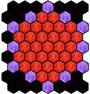
Not bad. This template covers all the 1 mile hexes that would fall completely inside the 6 mile hex. As a test I created a little village based hex:
 |
| Happy little village |
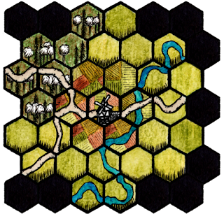
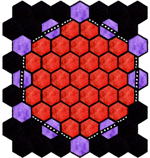
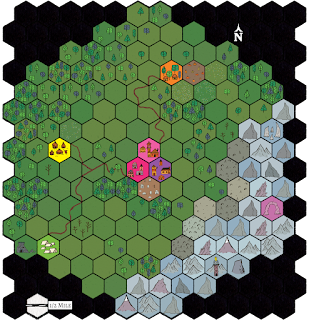
Each hex represents 1 mile. We have a happy little village in the centre, surrounded by farmland, with woods to the northwest and a road and river running through the area. This might be what you would use to zoom in on a hex marked as a farmland or a village on an overland map. For fun I thought I'd see what things looked like if I included the partial hexes (in purple) in the template and then added a border to distinguish the edge of the hex.
 |
| Without border |
 |
| With border |
I should mention the reason I'm going with point up hexes is that is the default in Hex Kit. There is a flat top option in the newer release, but most of the tiles are in point up orientation.
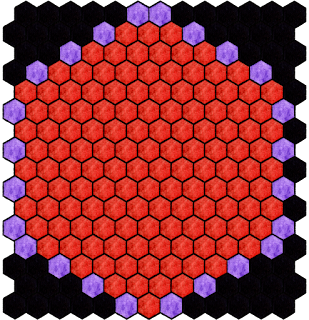
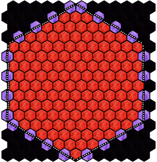
Next I decided to try the same thing with half-mile sub-hexes. Here's my templates:
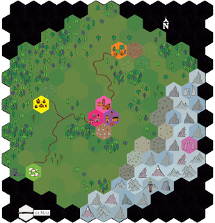
I had recently picked up the HPS Cartography Kit from Highland Paranormal Society as part of the Black Lives Matter itch.io bundle. Beautiful tiles. So I made another map using the above as a template. I included partial hexes in this one:
 |
| No hex overlay |
 |
| With hex overlay |
I think these turned out pretty well. I wanted to include a river, but I was having trouble making it work. While doing this map I also started diving deeper into what could possibly be contained in a 6 mile hex and it turns out this holds quite a lot. I have trouble picturing distances, especially when talking miles (remember, Canadian here). Turns out it would fit quite a lot, especially in medieval times. You might have several villages or towns inside that area.
I think that's enough rambling for now. If you would like a copy of the Hex Kit map files I used, please feel free to reach out to me. I know I have stated that these are meant to be 6 miles, but they could be any size that works in your game. What size hexes do you prefer to use in your hex maps?
***Note on copyright*** The above maps are licensed under a Creative Commons Attribution-NonCommercial-ShareAlike 4.0 International License. Per the HexKit license, maps created in Hex Kit using built in assests can be used and shared for non comercial purposes. Sharing or distributing individual map tiles is strictly prohibited. See the FAQ for further details here: https://coneofnegativeenergy.com/hex-kit/hex-kit-faq/




No comments:
Post a Comment